Mahabalipuram: The Shore Temple City
The Mahabalipuram Safarnama runs 10.3 km across 7 monuments, from Mamallapuram to Tiger Cave, part of The Temple Trail. Mahabalipuram is known as the shore temple city, here is the story the route tells, one stop at a time.
Mamallapuram
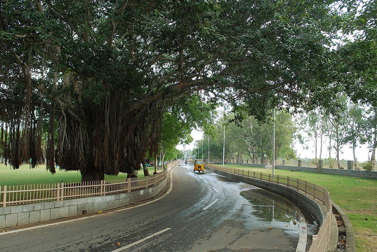
Named for the Pallava king Narasimhavarman I, also known as Mamalla, this coastal town was one of two major ports of the Pallava kingdom in the 7th and 8th centuries, trading as far as Southeast Asia. Its royal monuments, rock-cut caves, monolithic temple-chariots, a giant open-air relief and a shore temple, were carved from the living granite by the same dynasty, and the whole cluster was declared a UNESCO World Heritage Site in 1984. Today’s town plan was laid out by the British in 1827, on top of thirteen centuries of continuous settlement.
Pancha Rathas
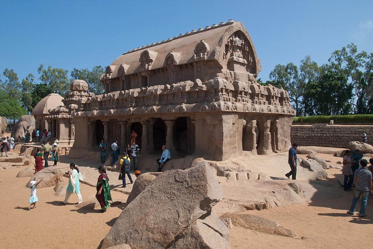
Five monolithic shrines, each carved downward from a single sloping granite boulder rather than built up stone by stone, named after the five Pandava brothers and their shared wife Draupadi from the Mahabharata. None was ever consecrated or fully finished, work stopped when Narasimhavarman I died around 668 CE, leaving each ratha a snapshot of a stone-carving technique mid-process. They are Indian rock-cut architecture at its most literal: not a building assembled from pieces, but a building subtracted from a single piece of ground.
Krishna’s Butterball
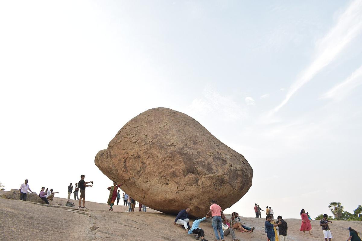
A granite boulder some six metres across, resting on a short natural incline at an angle that looks, to every visitor, like it should already have rolled away. Locals call it Vaan Irai Kal, the Stone of the Sky God; the more famous name compares it to a ball of butter Krishna stole as a child. King Narasimhavarman I is recorded as having tried and failed to move it in the 7th century, and in 1908 the British governor of Madras ordered seven elephants to pull it loose, they also failed. It has not shifted since.
Mahishasuramardini Cave Temple
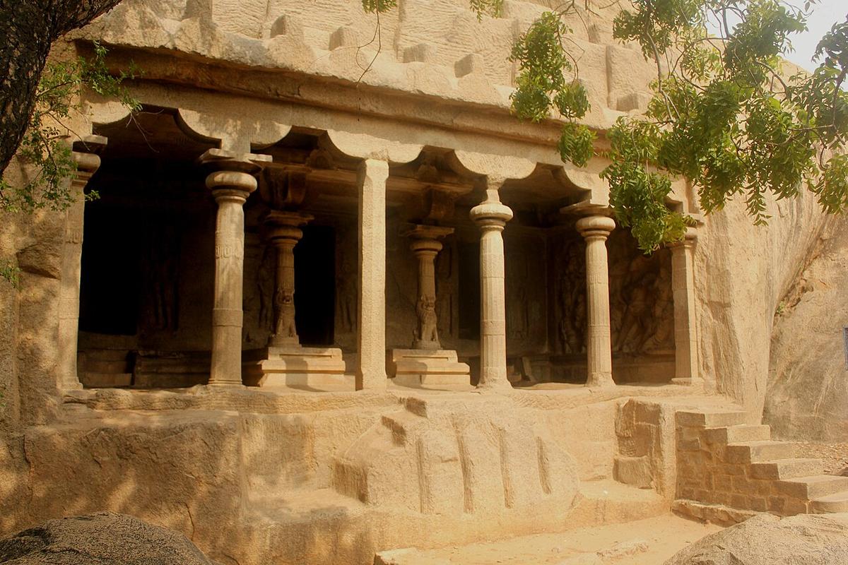
Cut into the same low rock outcrop that carries Mahabalipuram’s lighthouse, this late-7th-century cave temple holds three carved sanctums: Vishnu reclining on the serpent Adishesha, Shiva, and, the cave’s namesake and finest relief, Durga astride her lion, spear raised, slaying the buffalo-demon Mahishasura mid-battle. British surveyors later used the same hilltop for a working light: a lamp on the temple roof from 1887, replaced by a dedicated tower in 1900. Old defence of the sacred and new defence of passing ships, stacked on the identical outcrop.
Descent of the Ganges
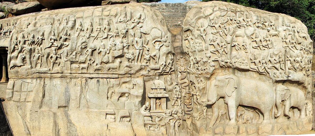
Known locally as Arjuna’s Penance, this open-air rock relief spans two adjoining granite boulders roughly thirty metres wide and thirteen high, carved with gods, sages, a life-size herd of elephants and a natural cleft in the rock that once carried real water, the whole composition built around the crack rather than despite it, so the story of the Ganges descending to earth literally flowed down the centre of the stone. It is generally dated to the mid-7th century and remains one of the largest and most ambitious rock reliefs anywhere in India.
Shore Temple
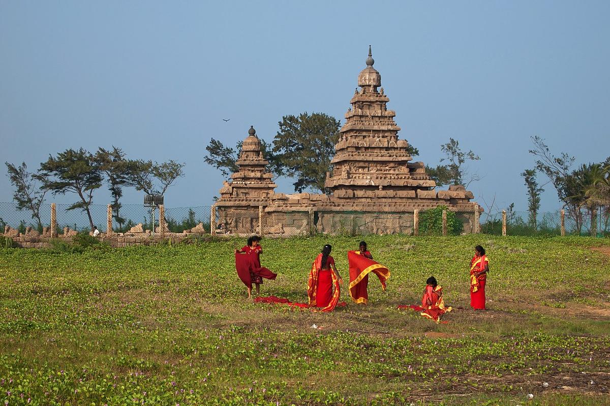
Built around 725 CE under Narasimhavarman II, the Shore Temple is one of the oldest structural, built up from cut stone blocks, rather than carved from one, temples in South India, the culmination of everything the Pallavas had been practising in the rock-cut caves and rathas before it. Marco Polo and later European sailors called this stretch of coast the Seven Pagodas, mistaking the temple for one of several such towers visible from the water; most modern scholars now believe the Shore Temple is the only one that ever stood above the waterline. Erosion and salt spray have worn its granite smooth, but it has watched the Bay of Bengal from this exact spot for thirteen hundred years.
Tiger Cave
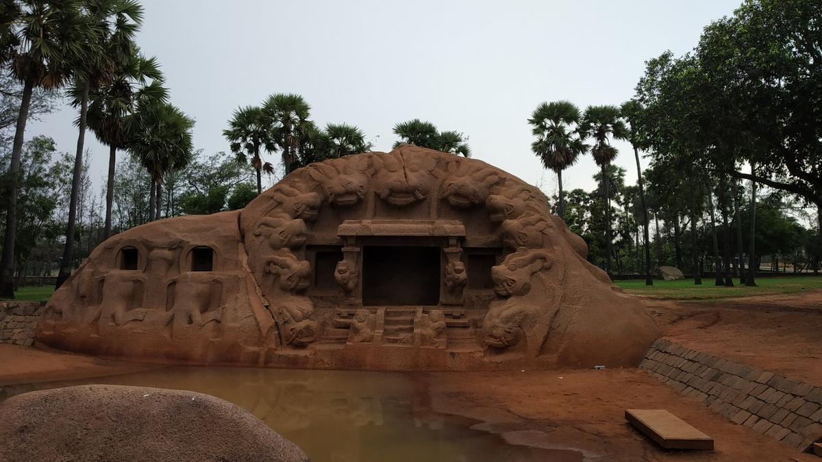
A single granite outcrop at Saluvankuppam, carved in the early 8th century under the Pallava king Rajasimha (Narasimhavarman II) into a shallow open shrine ringed by eleven yali heads, snarling, tiger-like guardian faces, with a small mandapa cut into the rock between them. Historians think its open stage and reflecting tank in front were built for royal performances and rituals rather than daily worship, making it as much a piece of theatre as a temple. In 2005, cleanup after the 2004 tsunami exposed something older buried right beside it: the brick foundations of a Subrahmanya (Murugan) shrine dated to the Sangam period, 3rd century BCE to 3rd century CE, the earliest known temple to that deity anywhere in Tamil Nadu, a full thousand years older than the tiger-headed rock beside it.